Until recently, there was nothing like Kenya. There was only, from Somalia down to the Comoros like the pearls of a Muslim rosary, a series of harbours of flourishing cities. Most were safely situated on islands where sailors had come since Antiquity from as far as Arabia, India and even China to trade and mix with the local African people. This is where the Swahili civilization blossomed.
In 1498, Vasco de Gama was the first European to reach the area. Portugal established a few strongholds along the Coast – Fort Jesus in Mombasa is a vestige of this occupation. Soon followed by other European powers, they became yet another actor of the tumultuous power struggles in the area.
In the hinterland, since the beginning of times – other people were living, peacefully or at war with each other, interacting, migrating, developing areas and societies, but with limited contacts with the Coast, and the outside world.
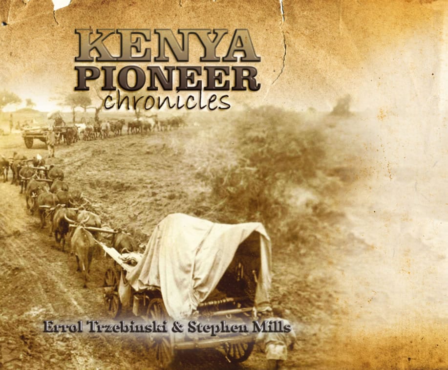
The Swahili traders – often called Arabs – had for a long time established links with the people of the mainland. Large caravans would be chartered, going farther and farther into the continent, generation after generation.
By the beginning of the 19th Century, they would start from Zanzibar and Bagamoyo on the mainland and reach the heart of Africa, the shores of the lakes known today as Tanganyika and Victoria, forming alliances with local chiefs and kings, even controlling large areas as in Kivu.
But the traders from Lamu, Malindi, Gedi, and Mombasa could not go that far. If they dared penetrate deep into the continent, fierce fighting herdsmen would attack the intruders, disband the caravans, and make the business a disaster. Nobody ventured farther than a few hundred miles. The only possible route was from Zanzibar, which was followed by the famous explorers such as Stanley, Livingstone and Burton, who “discovered” Africa, and the missionaries who came in their footsteps.
They ventured far and, to their amazement, reached a place which they described as a very developed political entity, the Kingdom of Buganda, on the shores of a lake they named Victoria Nyanza. The United Kingdom developed a strong interest in this area and, in alliance with the Kabaka of Buganda, took control over a large territory surrounding his kingdom, establishing the Uganda Protectorate, by 1894.
But there was a problem. As agreed in 1886, the usual route to Buganda, from Zanzibar, meant crossing territories henceforth under German domination, Tanganyika, while Britain had been attributed those stretching inwards north of -1° latitude from the Coast up to the Rwenzori Mountains.
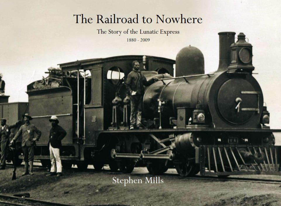
To gain free access to its Protectorate, Britain decided to cut across from Mombasa and reach the shores of Victoria Nyanza by train. From there, Uganda would easily be reached by boat. Consequently, they decided to build the Uganda Railway, and construction began in 1896.
Earlier, the young Lord Lugard, with a significant number of soldiers, Sudanese, Swahili, etc, completed the survey after the military had previously confirmed its feasibility and secured the new route by establishing a series of forts. The trained manpower to build the railway was imported from India, by the thousands. About a quarter of these often forced immigrants remained in the country. Many friends and relatives joined them, turning into shopkeepers in the new towns and the emerging modern villages.
The epic of the Uganda Railway building is narrated in a novel, “The Lunatic Express”, as it was nicknamed.
In 1899, as the construction was progressing towards the Lake, it was decided to establish a rail depot and workshops in a place the Maasai called Nairobi, located before the railhead reached the Big Escarpment.
The Uganda Railway reached Port Florence, today called Kisumu, in December 1901. Meanwhile, Nairobi was growing, as the main stop on the long railroad.
The British government, which had taken responsibility for the territory known as British East Africa (B.E.A.), decided in 1902 to transfer to B.E.A. the region called Kavirondo, bordering the Lake from Mount Elgon to Homa Bay, previously part of the Uganda Protectorate, so that the whole railway line, the backbone of the territory, could be under the same administration.
In 1905, it was decided to transfer the capital from Mombasa to Nairobi where the headquarters of the Uganda Railway was already situated. Yet, as can be seen on a map of 1906, the name of Nairobi does not even appear.
From there, a new political entity emerged. From the beginning of the century, British East Africa developed and took shape. Many immigrants arrived, white farmers from the U.K. and South Africa, Asians from British India, missionaries covering the country with churches and schools while the local populations, by will or whip, were introduced into the new world modernity.
Most of the postcards here date from this period, the first quarter of the 20th century. Many buildings were erected, urban centres appeared and grew, and new ways of life were adopted.
Then, in 1920, a major reorganisation was decided, B.E.A. becoming the Kenya colony, but for a strip of land along the Coast, where sovereignty was shared with the Sultan of Zanzibar, and which became the Kenya Protectorate.
That part of the British Empire was named after the highest mountain in the country, Mt Kenya. The name was kept after Independence.
This is how postcards tell the story of a nation in the making.